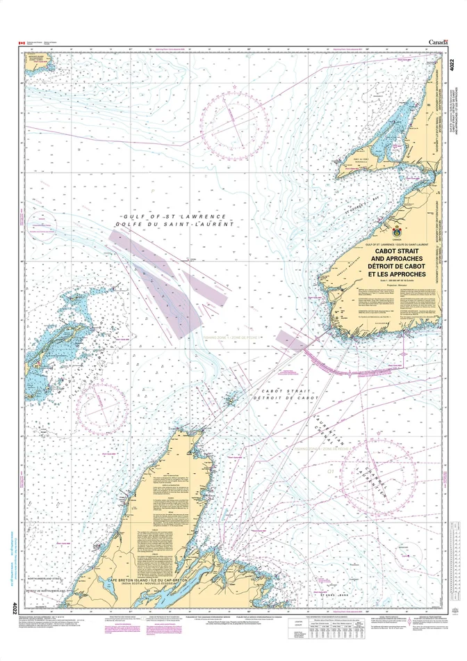
Description
At 152,100 miles, Canada has the longest coastline in the world! OceanGrafix and Landfall Navigation have joined forces to provide you with the most up-to-date nautical charts. Canadian charts come directly from the Canadian Hydrographic Service. The standard charts are water-resistant with a tough coating for longer life. Bright colors make them easier to read under varying light conditions.
Canadian Hydrographic Service (CHS) Chart Catalogs
CHS Region 1 Atlantic Coast (.pdf)
CHS Region 2 Pacific Coast (.pdf)
CHS Region 3 Ontario / Manitoba (.pdf)
CHS Region 4 Arctic (.pdf)
Size: 50″ x 36″
Scale: 350,000
Edition Date: 01/17/2003
Edition Number: 2
LNM Cleared Date: 08/11/2017

Reviews
There are no reviews yet.